5 reasons first responders should use Storm Relief & Recovery GPS tracking services
In every rescue operation, a critical part of success is time. The faster you respond the higher chances of saving lives and properties. What this means is that knowing the exact location of the landmarks, streets, emergency service resources and being able to communicate on a single press of a button can really save lives.
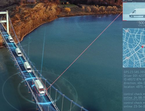
This brief addresses five main reasons why first responders should use storm relief and recovery GPS tracking systems. The information is very critical to disaster relief team and the public safety personnel. With GPS tracking systems for first responders from storm relief & recovery GPS tracking service provider GPS Leaders will help them save lives and eventually recover more properties.
Panic Buttons
Carrying portable trackers in such a situation is very beneficial because they offer panic buttons to notify dispatch when victims are found or if something is wrong. As the first responders are helping in the recovery process, there are little chances that they will have to get their phones and notify their colleagues whenever someone or something is recovered. For this reason, they all want to feel like they can actually do something with the use of GPS tracking devices.
The good thing is that GPS tracking devices have many features that can really help in such a situation. Again, the panic button is the most helpful because the responder will press a button and everybody will have a notification with the exact location. This shows that the team will easily locate the first respondent together with the victim.
Location of the responders
It’s also very easy to logistically know where first responders are located in order to deploy resources evenly in the area of interest. Imagine in case of a disaster, the rescue team doesn’t know the exact location of their colleagues or even know how they can reach out to them and assign duties.
In such situations, landmarks and neighborhoods are swept away . Now imagine the team crawling out from under the destroyed house to locate a landmark and tell their counterparts where they are? Will that not take a lot of their time? Definitely it will. For this reason, the rescue team should use GPS Units when they move in to evacuate the populace. They usually use these units to track their emergency vehicles, locating places that the vehicles can be more of help and at the same time locating the nearest personnel to a potential point.
Additionally, at the state of emergency, the crew will be responding to more than 1,000 calls a day which means that the coordination between one crew member and the other, the vehicles and the management is vital. The management should as well be able to determine the exact location of a fleet which will eventually determine how quickly help will arrive.
View all people and equipment with GPS tracking deployed
Additionally, it’s also possible to dispatch responders to the nearest equipment using Dashboard to view all the people and equipment with GPS tracking deployed. Being at a position to see all the crew members from one dashboard means you can easily locate the nearest responder to a case.
This is actually what will determine whether lives will be saved on time or there will be delays and confusion around the whole process. GPS also becomes the most reliable way of communicating in an emergency, you know how difficult it can be to communicate with the rescue team and at the same time get a briefing about the progress of the whole process.
The fact is that the search and the rescue operators are in constant communication. The drivers will need to be notified where road blockages are, congestion, accidents and the fastest way to get to the site.
Set up geofences
They also help in setting up geofences to be notified when first responders arrive and leave locations of interests. This is very beneficial in case the management wants to know whether the whole team has taken actions. When you are dealing with a big team of first responders, it’s usually crucial to have a way of knowing when they arrive and leave the locations where they are assigned duties.
Geofence will send direct notifications when the responder gets to the assigned site and eventually notify when they leave the site. You don’t have to go to the grassroots and supervise their operations, you can get the statistics from the operation equipment and geofences to know whether the operation was carried the right way or not.
Physical deliverance is such a troublesome thing to facilitate after a disaster. There are many people that are displaced from their homes and hence food supply is the most important thing they are anticipating. If you don’t monitor the operations, then they may suffer.
Monitor equipment usage with PTO Monitoring
It’s also getting very easy for you to monitor equipment usage with Power Take off monitoring and at the same time know when specific equipment is in use and for how long so to help manage fuel. With so many equipment being used all at once, it’s a nice thing to monitor fuel usage and get clear details of how these equipment are used.
The driver should be precise in regard to the destination and at the same time be at a position to use the company’s resources adequately. Manually, this can be the most daunting exercise to undertake. You need to be on ground to see how equipment are used which is practically not possible because of the number of equipment being used. The wisest decision in such a case is to go for the Storm relief and rescue GPS tracking devices. With features to monitor the driver’s behavior, fuel usage and capability to tell you which is the shortest way to the destination, you can expect that you will benefit significantly.
The above are some of the reasons why first responders needs GPs tracking devices from Storm relief & Recovery GPS tracking service provider GPS Leaders.